


Maps and Photos Show Devastating Scale of Los Angeles Wildfires
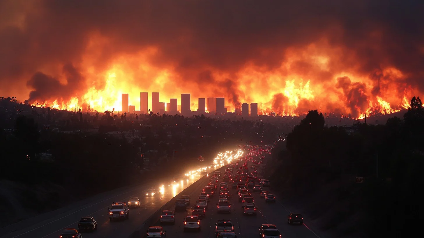
Los Angeles is grappling with a wildfire crisis of unprecedented scale. With at least 10 lives lost, thousands of structures destroyed, and tens of thousands of residents forced to evacuate, firefighters are working tirelessly to contain the infernos.
The fast-evolving situation is captured in maps and images, highlighting the fires’ scale, their rapid spread, and the destruction they’ve caused.
The Largest Blaze in LA History
The Pacific Palisades fire, the most devastating wildfire in Los Angeles’ history, has scorched nearly 20,000 acres. To put this in perspective, the affected area stretches across London from Clapham to Greenwich or covers significant parts of lower Manhattan and Queens in New York.
Visualizations of the fire’s expanse help convey its enormity, as maps show how it would overlay major urban centers.
Fires Across LA: A Breakdown
Currently, five major wildfires are active in and around Los Angeles, each presenting unique challenges:
- Palisades Fire: The largest, located between Santa Monica and Malibu.
- Burned: 20,438 acres
- Destruction: Over 5,300 structures lost
- Evacuations: 30,000+ residents
- Eaton Fire: Burning north of Pasadena.
- Burned: 13,956 acres
- Impact: More than 4,000 structures damaged or destroyed
- Deaths: Five fatalities reported
- Kenneth Fire: In the West Hills area near the Palisades.
- Burned: 1,000 acres
- Hurst Fire: Northeast of LA.
- Burned: 771 acres
- Lidia Fire: In the hills north of the city.
- Burned: 395 acres
Three smaller fires have been successfully contained:
- Woodley Fire: 30 acres burned in local parkland.
- Olivas Fire: 11 acres burned in Ventura County.
- Sunset Fire: 43 acres burned in the historic Hollywood Hills, sparing famous landmarks.
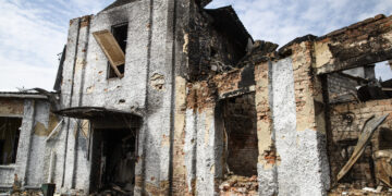
Thousands of Homes Lost
The devastation is staggering, with more than 10,000 structures destroyed by the two largest fires—half in the Palisades blaze and the other half in the Eaton fire. Among the destroyed properties are luxury homes in Malibu and historical landmarks like the Jewish Temple in Pasadena, which had been a community cornerstone since 1941.
Maps and satellite imagery show how the flames have encroached on populated areas, with many buildings already lost and more at risk.
What’s Driving the Fires?
Southern California’s combination of extreme drought, dry vegetation, and powerful Santa Ana winds has created a perfect storm for wildfires. These winds, blowing east to west, reduce humidity, turning already dry brush into tinder. Once ignited, flames can escalate into raging infernos within minutes.
Rapid Spread and Ongoing Efforts
The speed at which the fires have grown is alarming. In just a few hours, the Palisades fire expanded from 772 acres to over 20,000 acres. Similarly, the Eaton fire surged from 1,000 acres to 13,000 acres, displacing thousands.
More than 1,400 firefighters are battling the Palisades fire alone, while crews across the region work to contain other blazes.
Capturing the Aftermath
Heartbreaking before-and-after images reveal the toll on communities. From Malibu’s beachfront homes to small businesses in Pasadena, the destruction is immense. A once-thriving cafe and a bait shop are now charred remnants.
Financial and Environmental Impact
Early estimates suggest the financial cost of the wildfires will exceed $135 billion, making them among the most expensive in U.S. history.
There is some hope, however. Weather forecasts indicate slightly improved fire conditions, with the critical danger level downgraded. However, no rain is expected in the coming week, keeping the risk of flare-ups high.
As authorities continue their fight against the flames, the full extent of the devastation is still unfolding. For now, communities across Los Angeles brace for the long road to recovery.


